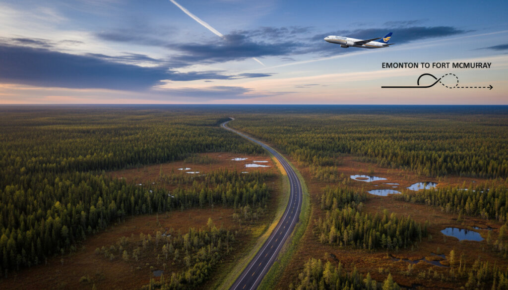
Edmonton to Fort McMurray – Distance, Drive Time, Flights and Options
Fort McMurray sits roughly 435 kilometers northeast of Edmonton, a distance that translates to roughly four and a half hours behind the wheel under ideal conditions. The route serves as a vital corridor connecting Alberta’s capital to the heart of the oil sands region, carrying thousands of workers, residents, and visitors each month.
Multiple transport modes compete for travelers’ attention. Driving offers flexibility and control over departure times, while direct flights slash transit duration to just over an hour in the air. Ground transport alternatives including scheduled buses provide middle-ground solutions for those without vehicle access.
Choosing between these options requires balancing cost against convenience. Fuel expenses for the drive typically run under one-sixth the price of a one-way airfare, yet flying eliminates nearly four hours of travel time. Understanding the specific distances, durations, and variables affecting each method allows for informed decisions tailored to individual schedules and budgets.
How Far is Fort McMurray from Edmonton?
The straight-line distance between the two cities measures approximately 400 kilometers, though practical travel routes extend slightly longer. Highway corridors add necessary detours around natural obstacles and through service communities.
| Driving | Flying | Bus | Rideshare | |
|---|---|---|---|---|
| Distance/Time | 436 km / 4h 45m–5h | 1h flight + airport time | 5h–5.5h | Variable |
| Cost Estimate | $86–123 (fuel) | $588–748 | $75–130 | Variable |
| Pros | Flexible schedule; door-to-door | Fastest option; daily departures | Cheapest; no driving fatigue | Potential door-to-door |
| Cons | Weather dependent; driver fatigue | Expensive; airport transfers | Fixed schedules; depot transfers | Unreliable; safety concerns |
Key insights for route planning:
- Driving remains the most cost-effective option for groups, with fuel costs split among passengers dropping below bus fares per person.
- Red Arrow and Cold Shot provide the most reliable bus schedules, with twice-daily departures from central Edmonton.
- Winter conditions on Highway 63 can add significant delays between November and March, regardless of transport mode.
- Flight prices fluctuate dramatically based on oil sector demand, with weekdays often commanding premium rates.
- No direct rail service exists between the cities, leaving road and air as the only scheduled public options.
- Departing from Edmonton International Airport adds approximately 30 minutes to driving calculations compared to downtown starts.
- Fort McMurray Airport (YMM) lies within municipal limits, reducing ground transport needs upon arrival compared to larger hubs.
| Fact | Details |
|---|---|
| Straight-line distance | ~400 km |
| Driving distance | 432–436 km |
| Primary highway | Highway 63 |
| Secondary routes | Highways 28A and 28 |
| Edmonton airport code | YEG (Edmonton International) |
| Fort McMurray airport code | YMM |
| Drive time (optimal) | 4h 45m–5h |
| Bus travel time | 5h–5h 30m |
| Flight duration (airborne) | ~1 hour |
| Door-to-door flight time | ~3h 26m |
How Long Does It Take to Drive from Edmonton to Fort McMurray?
The journey north follows a straightforward path through Alberta’s boreal landscape. Motorists leave Edmonton via Highway 28A, transitioning to Highway 28 before merging onto Highway 63, the primary artery running directly into Fort McMurray.
Highway route details
The route begins at the junction of Manning Drive and Highway 28A on Edmonton’s northern edge. After approximately 50 kilometers, drivers transition onto Highway 28, continuing through agricultural zones and boreal forest. The final leg utilizes Highway 63, a divided highway maintained specifically to handle heavy industrial traffic serving the oil sands operations. Road Trip Alberta notes the road surface remains mostly straight and flat, with few elevation changes to impede progress.
Factors affecting drive time
Seasonal weather patterns dictate realistic arrival windows. Winter storms between November and March can coat Highway 63 in ice, reducing safe speeds significantly. Summer construction zones occasionally narrow lanes through rural stretches. Peak travel times correlate with oil sector shift changes, creating bottlenecks near Fort McMurray’s southern industrial parks during early morning and late afternoon hours.
Alberta Transportation recommends checking 511 Alberta for real-time highway conditions before departure. Ice and snow accumulation on Highway 63 can extend travel time by 60 to 90 minutes during active weather systems.
Departing from Edmonton International Airport (YEG) rather than downtown adds roughly 30 minutes to the initial leg, requiring navigation through Leduc and Nisku industrial areas before reaching the main highway corridor.
What Are the Flight Options from Edmonton to Fort McMurray?
Air travel provides the fastest connection between the cities, though total transit time includes ground transport to and from airports. Several carriers operate the route with varying frequencies depending on seasonal demand.
Airlines and airports
WestJet and other regional carriers operate direct flights from Edmonton International Airport (YEG) to Fort McMurray Airport (YMM). The Fort McMurray facility sits within city limits on MacDonald Avenue, eliminating lengthy transfers common with larger metropolitan airports. Edmonton International lies 30 kilometers south of the city center, accessible via public transit, taxi, or rideshare services.
Flight duration and costs
The airborne segment lasts approximately 60 minutes. When combined with airport security, boarding procedures, and ground transport at both ends, total door-to-door time averages 3 hours and 26 minutes according to City to City Express. One-way fares typically range between $588 and $748, positioning air travel as the premium option for time-sensitive journeys.
Flight prices fluctuate based on oil sector activity. Booking several weeks in advance often secures lower fares, though last-minute tickets for business travel can exceed $800 one-way during peak industrial seasons.
Are There Bus or Other Ground Transport Options?
Scheduled bus services provide the most economical alternative to driving or flying. Multiple operators maintain regular routes between Edmonton and Fort McMurray, catering specifically to oil sands workers and residents without vehicle access.
Bus schedules
Red Arrow operates twice-daily departures from 10014 104 Street in central Edmonton, arriving at 10013 Macdonald Avenue in Fort McMurray after approximately 5 hours and 10 minutes. The service includes WiFi and power outlets. Rider Express and Ebus offer daily or thrice-weekly alternatives with one-way fares between $75 and $130, sometimes routing through Grassland at the Esso station on Highway 63. Rome2Rio listings indicate Cold Shot provides nearly daily service with competitive pricing around $70, though schedules vary by season.
Rideshare and shuttle info
No formal rideshare apps dominate this corridor, though informal carpooling arrangements circulate through industrial workplace bulletin boards. Travelers must arrange local transport to and from bus depots in both cities, as public transit connections remain limited, particularly in Fort McMurray’s peripheral industrial zones.
Edmonton’s central bus terminal connects easily to the LRT and taxi services. In Fort McMurray, the Macdonald Avenue depot lies within the urban core, but travelers heading to remote work camps should arrange employer-provided shuttles or rental vehicles in advance.
What Does the Journey Timeline Look Like?
Understanding the sequence of travel stages helps planners allocate realistic timeframes. Whether driving, flying, or taking ground transport, certain milestones mark progress along the route.
- Departure preparation: Gather weather forecasts for Highway 63 or confirm flight status 24 hours ahead. Pack appropriate clothing for Fort McMurray’s potentially harsher climate.
- Edmonton exit: Navigate through northern Edmonton via Manning Drive or depart from YEG airport, accounting for morning rush traffic between 7:00 and 9:00 AM.
- Grassland transition: Located roughly halfway along the driving route, this service stop marks the transition from Highway 28 to Highway 63, offering fuel and food options.
- Boreal forest traverse: The final 200 kilometers pass through dense forest with limited cellular service. Drivers should ensure adequate fuel, as stations become sparse north of Grassland.
- Fort McMurray approach: Highway 63 widens as it enters the municipality, passing industrial facilities before reaching the urban core or airport turnoff.
What Information is Definite and What Remains Variable?
Certain metrics remain constant regardless of booking date or season, while other factors require real-time verification.
| Established Facts | Variable Conditions |
|---|---|
| Highway distance measures 432–436 km | Fuel prices fluctuate with global oil markets |
| Bus services run daily via multiple operators | Winter weather delays of 1–2 hours possible |
| Flight time airborne is approximately 60 minutes | Airfare varies from $400–$800+ seasonally |
| Highway 63 is the primary route | Construction schedules change annually |
| Edmonton International (YEG) serves both flights and rentals | Rental car availability depends on demand |
Why Do People Travel Between Edmonton and Fort McMurray?
The corridor functions as Alberta’s primary economic artery for oil sands operations. Fort McMurray serves as the service and accommodation hub for vast bitumen extraction sites north of the city. Workers commute on rotation schedules, typically working 14 days followed by 14 days off, creating predictable surges in travel demand.
Beyond industrial traffic, the route supports supply chain logistics, with transport trucks carrying equipment and provisions northbound while hauling materials south. Medical referrals and specialist appointments also drive travel, as Fort McMurray’s regional hospital redirects complex cases to Edmonton’s advanced medical facilities. Before departing, some travelers check the No Frills Flyer Brampton for supply pricing comparisons, though Fort McMurray maintains distinct retail markets.
The drive itself offers little in terms of tourism infrastructure, functioning purely as a utilitarian connection rather than a scenic route. Most travelers prioritize efficiency over sightseeing when navigating this particular stretch of northern Alberta.
Where Does This Information Come From?
Travel data derives from operator schedules, transportation authority reports, and real-time booking platforms. Alberta Transportation maintains current road condition databases, while airport authorities publish operational statistics. Primary research aggregates findings from route guides, transit aggregators, and regional transport services.
“The road is mostly straight, flat, and well-maintained, but add time for peak traffic, winter conditions, or starting from Edmonton International Airport.”
— Road Trip Alberta route analysis
“Daily direct flights available between Edmonton and Fort McMurray, with total door-to-door time averaging 3 hours 26 minutes including ground transport.”
— City to City Express travel comparison
What is the Best Way to Travel?
The optimal transport mode depends entirely on budget constraints and time sensitivity. Driving offers unmatched flexibility for groups, with per-person costs dropping below $25 when splitting fuel expenses four ways. Solo travelers prioritizing economy should examine Red Arrow or Cold Shot bus services, which undercut driving costs when accounting for vehicle wear and single-occupancy fuel consumption. Executives and those on tight schedules gain the most value from direct flights, despite the significant price premium. For those preparing for remote travel, reviewing How to Stop Bleeding Quickly provides essential first-aid knowledge for highway emergencies.
Frequently Asked Questions
Is there a train between Edmonton and Fort McMurray?
No direct rail service connects the cities. VIA Rail does not operate lines into Fort McMurray. Travelers must choose between driving, flying, or bus services.
Do I need winter tires to drive Highway 63?
While not legally mandated year-round, winter tires are strongly recommended from October through April. Highway 63 traverses remote boreal forest where sudden snowstorms create hazardous conditions.
Can I fly direct from downtown Edmonton?
No commercial flights operate from Edmonton City Centre Airport (YXD) to Fort McMurray. All flights depart from Edmonton International Airport (YEG), requiring ground transport to reach the terminal.
Are there scenic stops along the driving route?
The route serves primarily industrial and utilitarian purposes. While the boreal forest provides natural scenery, designated tourist stops remain limited. Most travelers treat the drive as a direct transit rather than a sightseeing journey.
How early should I arrive at Fort McMurray Airport for flights to Edmonton?
Arrive 90 minutes before departure for domestic flights. The smaller regional airport processes security quickly, but oil sector flight demand can create unexpected congestion during shift-change periods.
Can I rent a car in Fort McMurray if I fly there?
Yes. Major rental agencies maintain desks at YMM airport. However, vehicle availability fluctuates with industrial demand. Booking rental cars weeks in advance proves essential, particularly during major project ramp-ups.
Is cellular phone service available along Highway 63?
Service remains strong between Edmonton and Grassland, but significant dead zones exist north of the halfway point. Download offline maps before departure and ensure vehicles carry emergency supplies.
More related posts
 Mangrove Beach Corendon Curacao – All-Inclusive Resort Guide
 Canada Election Results Map 2025: Official Seat Distribution
 Savannah Guthrie: Medical Condition, Surgery, Salary & More
 Shoppers Drug Mart Kelowna – All Locations Hours Contacts
 What Is a VPN? A Beginner’s Guide to Virtual Private Networks
 News Today in the World: Top Headlines & Global Updates
 Alison Brie Kids: No Children with Dave Franco & Religion